![]()
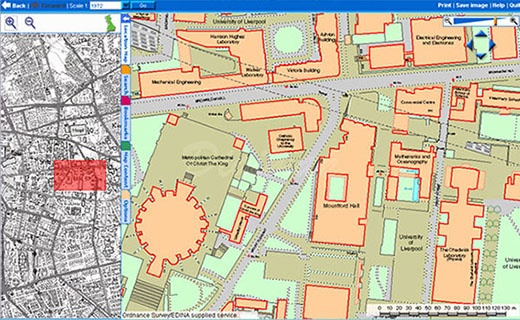
Digital maps of the UK are available from any PC via
DigiMap.Edina.ac.uk
Topography including buildings is available from OS MasterMap in DWG format.
The plan option is 2D line format, specific layers can also be chosen.
Contour and building height data is also available...
David Sherren is the Map Librarian should you need advice.

Open the DWG (2007) with Adobe Illustrator.
Scale: 50, 100... as required & Unit(s) = 1 & (change points to) millimeters
From Options: Layout choose the Model unless you scale at 100% above.